


Precision in Cofferdam Site Assessment: Ensuring Geotechnical Excellence
View the complete article here.
This guide explores the critical process of cofferdam site assessment—detailing the techniques, challenges, and best practices for evaluating sites in waterlogged environments. It is designed for geotechnical engineers and contractors working on marine and construction projects like bridge piers, pipeline installations, and other related projects. The goal is to provide actionable insights that ensure safe, efficient cofferdam design and installation—minimizing risks and enhancing project success.
Understanding the Basics of Cofferdam Site Assessment
Cofferdam site assessment lays the groundwork for successful temporary cofferdam projects by ensuring all critical factors are evaluated before design and installation begin.
What Is Cofferdam Site Assessment?
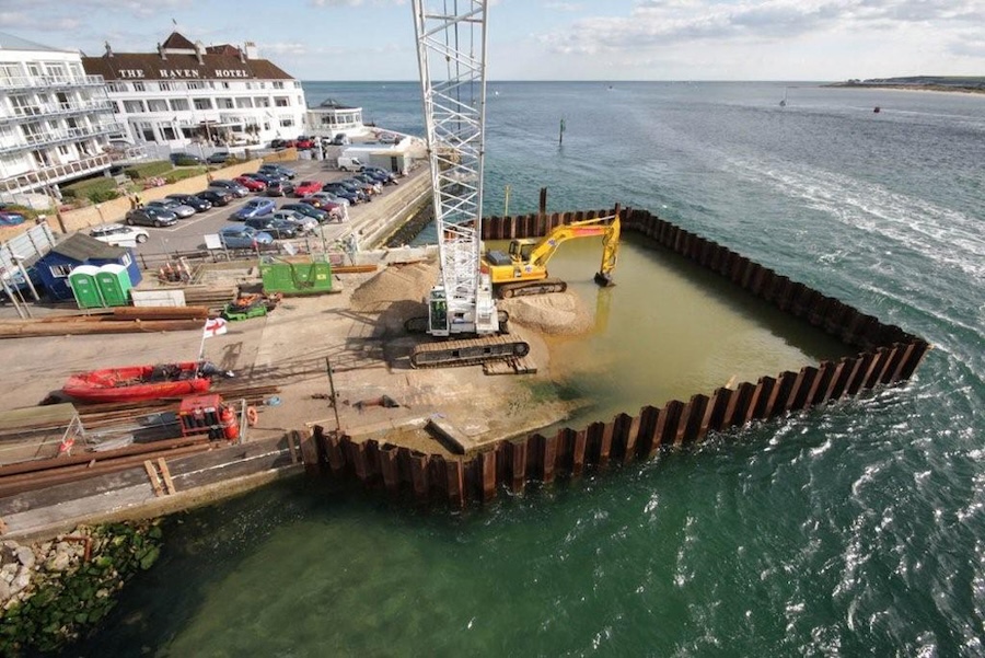
Cofferdam site assessment is the process of evaluating environmental, geotechnical, and logistical factors—such as soil conditions, water dynamics, and site accessibility—to design and install a temporary cofferdam effectively. This systematic approach—typically led by geotechnical engineers—ensures the cofferdam can create a safe, dry work area in waterlogged environments for construction projects.
Key Objectives
The primary goals of site assessment include determining soil stability to support the cofferdam structure, assessing water conditions like depth and flow to manage hydrostatic pressure, and identifying regulatory constraints such as environmental permits to ensure compliance. These objectives inform the cofferdam’s design, ensuring it meets project requirements while minimizing risks of failure or delays.
Common Applications
Cofferdam site assessments are essential for projects like bridge pier construction, where a dry area is needed for foundation work in rivers—pipeline installation in lakes or coastal zones requiring precise underwater access—and dam repairs in reservoirs to isolate sections for safe maintenance. These applications highlight the need for thorough assessments to address site-specific challenges in marine and construction environments.
Key Factors in Cofferdam Site Assessment
A thorough cofferdam site assessment hinges on evaluating critical factors that influence design and installation, ensuring stability and compliance in challenging environments.
Geotechnical Conditions
Geotechnical conditions are assessed through soil testing, such as borehole sampling, to evaluate soil type, shear strength, and bearing capacity—which determine the cofferdam’s foundation stability. These tests, often conducted by geotechnical engineers, reveal whether the soil can support the structure or if additional reinforcement, like deeper piles, is needed to prevent settlement or failure.
Hydrological and Hydraulic Analysis
Hydrological and hydraulic analysis involves assessing water depth, current velocity, tidal fluctuations, and wave forces to design a cofferdam capable of withstanding hydrostatic pressure and dynamic water loads. Understanding these factors ensures the cofferdam’s walls and sealing systems can resist water forces, maintaining a dry work area throughout the project duration.
Environmental and Ecological Considerations
Environmental assessments focus on evaluating fish habitats, water quality, and sediment disturbance to minimize ecological impact and comply with regulations like the Clean Water Act. By identifying sensitive areas and potential impacts early—engineers can implement mitigation measures, such as silt curtains or fish relocation, to protect local ecosystems while meeting permitting requirements.
Site Assessment Techniques and Tools
Effective cofferdam site assessment relies on a combination of field techniques, monitoring tools, and analytical software to gather and interpret data for informed design decisions.
Field Investigation Methods
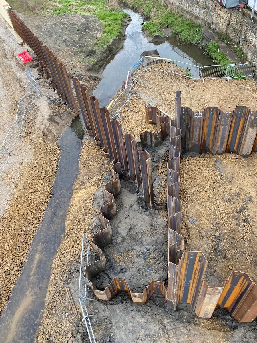
Field investigations employ techniques like borehole drilling to sample soil and rock layers, cone penetration testing (CPT) to measure soil resistance and stratigraphy, and geophysical surveys such as seismic refraction to map subsurface properties—while temporary cofferdam systems like PortaDam can create a dry work area for these assessments, ensuring safe and accurate data collection without environmental disruption. These methods provide essential data on soil composition, stability, and potential weak zones—enabling engineers to identify risks and tailor cofferdam designs accordingly.
Hydrological Monitoring
Hydrological monitoring uses tools like current meters to measure water flow velocity, tide gauges to track tidal fluctuations, and piezometers to monitor groundwater levels and pressure—all of which influence cofferdam design. These instruments help engineers understand water dynamics, ensuring the cofferdam can withstand hydrostatic forces and maintain a dry work environment throughout the project.
Analytical Software for Assessment
Analytical software like PLAXIS and GeoStudio enables engineers to model soil-water interactions, simulate cofferdam performance under site-specific conditions, and predict potential failure scenarios—while SPW911, a trusted sheet pile design software from Pile Buck, offers specialized capabilities for designing braced cofferdams by analyzing wall pressures and stability. By integrating field data—these tools provide detailed insights into stability, seepage, and load distribution—guiding the design of a cofferdam that ensures safety and efficiency.
Challenges in Cofferdam Site Assessment
Cofferdam site assessment often encounters complex challenges that can impact project timelines and stability, requiring careful planning to overcome effectively.
Unpredictable Subsurface Conditions
Unpredictable subsurface conditions, such as hidden soft soil layers or bedrock variations, can complicate cofferdam design and installation by affecting load-bearing capacity and stability. These issues may lead to unexpected settlement or the need for deeper piles, necessitating thorough geotechnical surveys to identify and address them before construction begins.
Dynamic Water Conditions
Dynamic water conditions—including tidal changes, storm surges, or high currents—can skew assessment accuracy and challenge cofferdam stability by exerting variable forces on the structure. Engineers must account for these fluctuations during site assessment, using real-time monitoring to ensure the cofferdam design can withstand the most extreme water conditions expected during the project.
Regulatory and Permitting Hurdles
Navigating environmental permits, such as those required under the Clean Water Act, and local regulations can delay projects if not addressed early—as they often involve strict guidelines on water quality and ecological impact. Early engagement with regulatory bodies and proactive compliance planning are essential to secure permits efficiently and avoid costly setbacks.
Best Practices for Effective Site Assessment
Adopting best practices in cofferdam site assessment ensures a robust foundation for design and installation, minimizing risks and enhancing project outcomes for geotechnical engineers.
Comprehensive Data Collection
Thorough field and lab testing, such as borehole sampling and soil shear strength analysis, is essential to build a complete picture of site conditions before cofferdam design begins. This comprehensive data collection helps identify potential issues like weak soil layers or high groundwater levels, enabling engineers to make informed decisions and avoid costly surprises during construction.
Collaboration with Experts
Collaborating with geologists, hydrologists, and environmental consultants ensures all factors—such as subsurface stability, water dynamics, and ecological impacts—are thoroughly considered during the assessment. This multidisciplinary approach fosters a holistic understanding of the site, improving the accuracy of the cofferdam design and ensuring compliance with environmental regulations.
Contingency Planning
Preparing for unexpected findings, such as adjusting cofferdam design for unforeseen soft soil or modifying dewatering plans due to high groundwater, is critical for maintaining project timelines and safety. Contingency planning allows engineers to adapt quickly to assessment results, ensuring the cofferdam can handle site-specific challenges without compromising stability or efficiency.
Case Study: A Successful Cofferdam Site Assessment
A real-world example illustrates how effective site assessment can lead to a successful cofferdam project, offering valuable lessons for geotechnical engineers and contractors.
Project Overview
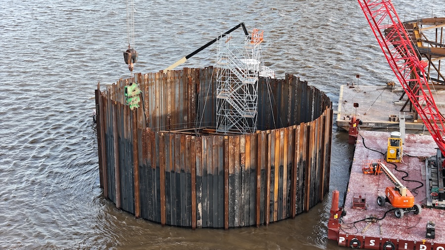
In 2023, a bridge pier project in Florida’s St. Johns River required a temporary cofferdam to create a dry work area for foundation construction in a 15-foot-deep section of the river. The project, led by a geotechnical engineering firm, aimed to install concrete piers for a new highway bridge—necessitating a robust cofferdam to withstand seasonal flooding and tidal fluctuations.
Assessment Process
The site assessment began with borehole drilling to evaluate soil stability, revealing a mix of sandy loam and clay with adequate bearing capacity—while tide gauges monitored water levels to account for daily tidal changes of up to 3 feet. Additional geophysical surveys mapped the riverbed for bedrock depth, and piezometers measured groundwater pressure—ensuring the cofferdam design could handle the site’s hydrological and geotechnical conditions.
Outcome and Lessons Learned
The thorough assessment enabled the team to design a sheet pile cofferdam with internal bracing, successfully installed to create a dry work area—allowing pier construction to proceed on schedule with no water intrusion issues. Key takeaways include the importance of integrating multiple assessment methods, like borehole drilling and tide monitoring, to address site-specific challenges—and the value of early environmental planning to secure permits, ensuring a seamless project execution.
View the complete article here.
What is the main purpose of cofferdam site assessment?
To evaluate soil, water, and environmental conditions for safe and effective cofferdam design and installation.
What techniques are commonly used for cofferdam site assessment?
Borehole drilling, cone penetration testing, and hydrological monitoring are commonly used techniques.