Chapter 9 – Coastal Bridges
- Chapter 1 – Introduction
- Chapter 2 – Coastal Highways
- Chapter 3 – Tides, Storm Surge and Water Levels
- Chapter 4 – Waves
- Chapter 5 – Coastal Sediment Processes
- Chapter 6 – Coastal Revetments for Wave Attack
- Chapter 7 – Roads in Areas of Receding Shorelines
- Chapter 8 – Highway Overwashing
- Chapter 9 – Coastal Bridges
From ‘Highways in the Coastal Environment: Second Edition’ by FHWA
Chapter 9 – Coastal Bridges
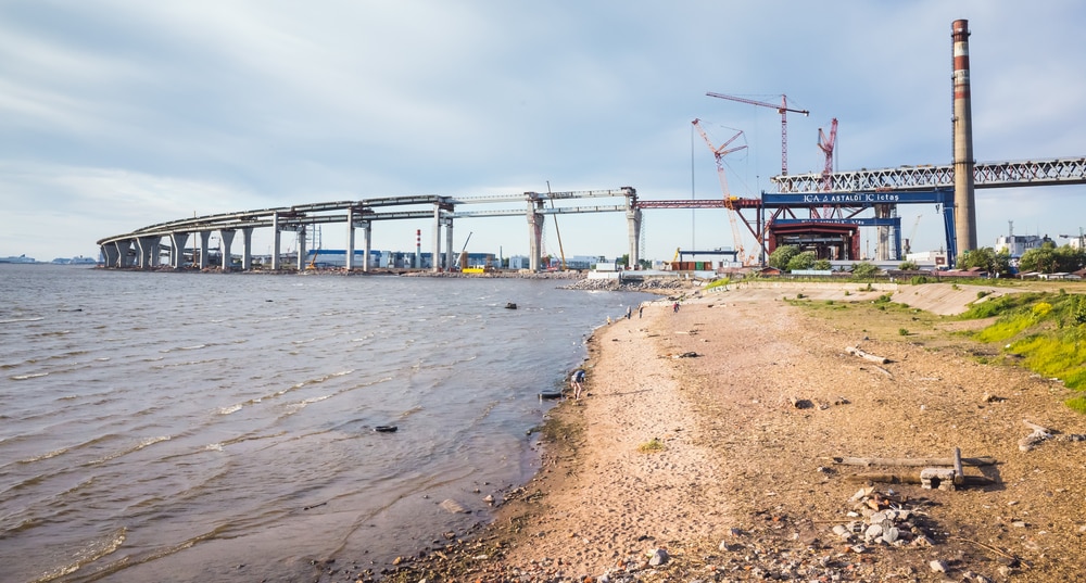
The FHWA estimates that there are over 36,000 bridges located within 15 miles of coastal waters of the United States (FHWA 2007). While a notable number of structures, this only represents 6 percent of the approximately 600,000 bridges contained within the National Bridge Inventory (NBI) (FHWA 2007)3.
For perhaps this reason, many SDOT drainage manuals apply riverine based hydraulic design concepts and approaches to these coastal bridges. For example, flow and water surface elevations at riverine bridges can frequently be fairly well represented by assuming steady uniform flow with reasonably long flow durations. This justifies use of relatively straight forward hydrologic approaches (regression equations, rainfall/runoff models) to develop peak design flows. Likewise, given these peak flows, practitioners generally use steady flow, one-dimensional models to estimate velocities, backwater, and other hydraulic design constituents.
However, the complicated hydrogic and hydraulic processes in the coastal environment may render such assumptions inappropriate for coastal bridges. Astronomical tides have reversing flows and may also have substantial ranges. These result in associated depths and velocities that vary significantly over a relatively short period of time. In addition to tidal fluctuations, hydraulic analyses need to consider and determine design storm surge and design wave heights, increasing the complexity.
Typical modeling assumptions and approaches (i.e., use of steady flow, one-dimensional models) usually do not apply to coastal bridges and may lead to problematic results and interpretations. For example, some analyses attempt to equate design flow and design surge elevation. This is a faulty assumption. During a flood event in a riverine system, the channel cross sections defining the floodplain also provide the limits of flow conveyance and thus the associated flow depth of that flood (i.e., flood quantity determines water elevation). During a design surge event, the water levels extend over a much larger geographical area with water depths limited by those factors described in section 3.2, “Storm Surge.” Therefore, at any particular location, the water elevation (head) determines flow quantity (i.e., water elevation determines flow). Additionally, as described earlier, the highly time dependent nature of coastal hydrologic and hydraulic processes (described above) preclude steady flow approaches, adding intricacy to the modeling effort.
Coastal bridge complexities are not just related to hydrologic and hydraulic processes. The orientation of the coastal bridge to “flow” direction may be quite different than a typical riverine bridge. At such riverine bridges the goal is to place the bridge as perpendicular as possible to the natural design flood flows direction. In many cases coastal bridges are not transverse the stream thalweg, but are in-line with the direction of the surge. Do such surges induce velocities sufficient for scour formation? Or a bridge located within an embayment may be, depending on storm direction, be subject to wave scour or wave loads, whereas for other storm directions, the bridge could be reasonably safe.
Therefore, even more so than riverine bridges, the level of engineering for coastal bridges requires consideration of forces and processes unique to the coastal environment including tidal bridge scour potential and hydrodynamic loads from waves and tidal currents. Wave and current loads on the sub-structure components of coastal bridges such as piles, pile caps, etc. are unavoidable and require investigation.
This Chapter provides an overview on several related hydraulic aspects of bridges in the coastal environment. These include the location of the bridge within the coastal floodplain, coastal bridge scour, coastal wave loads, and other important issues.
9.1 Locations of Coastal Bridges
Coastal bridges can be found at four general locations within the coastal environment: inlets, causeways, tidal arms/embayments, and river mouth crossings (Figure 9.1). Each type of location presents different issues and challenges for the hydraulic and coastal practitioner.

Conceptual schematic of four typical bridge locations within the coastal environment.
9.1.1 Bridges at Inlets
Inlets are where the tides move between the ocean and a bay (see Section 5.6, “Tidal Inlets”). Inlets are the entrance to many estuaries and other water bodies of ecological importance. These interior bays and estuaries can store significant volumes of water. Inlets experience complex hydrodynamics, some with extremely intricate interactions between currents and sands. Most shoreline change is near inlets; many are “evolving” geologically in response to engineering and natural changes. There can be multiple inlets to the interior water body (bay, sound, etc).
The United States has over 600 tidal inlets, of which many have bridges across their throat. These can range from very large structures (e.g., Golden Gate Bridge) to relatively small spans (Gulf Shores, Alabama; seen in Figure 9.2). Depending on the exact configuration of the bridge and tidal inlet, the bridge will exhibit varying levels of hydraulic control between the ocean and interior water body. Even bridges “spanning” the inlet during daily astronomical tides fluctuations may exhibit some hydraulic control when surge and wave levels reach a certain point.

Bridge spanning small inlet (SH 182 in Gulf Shores, Alabama).
9.1.2 Bridge Causeways
Causeway bridges typically link coastal and barrier islands and peninsulas to the mainland. They can consist of bridges or a combination of bridges and elevated embankments. The floodplain crossing can be some combination of open water and wetlands (or other low-lying crossing floodplain system. For example, Figure 9.3 depicts the Ben Sawyer causeway bridge near Charleston, South Carolina. The causeway bridge leads from Mount Pleasant (mainland) to Sullivan’s Island. The causeway bridge (like many such structures) serves as an evacuation route during storm events. The NBI records the actual bridge length as 1150 feet, straddling the Intercoastal Waterway (FHWA 2007)4 . However, the embankment portion of the causeway extends many thousands of feet (arrows differentiate between bridge and embankment).
This causeway bridge also illustrates some of the hydrologic and hydraulic complexities affiliated with such structures – direction of surge relative to the bridge and orientation. The FEMA FIS flood insurance rate map (FIRM) describes that the 100-year stillwater surge elevation will reach 14 to 15 feet (plus any additional waves on top of that stillwater) (FEMA 2004). However, the FIRM appears to indicate the surge direction is roughly perpendicular with the direction of beach orientation – surge “moves” in the same (longitudinal) direction as the bridge and embankment. While the Ben Sawyer causeway bridge crosses marsh regions, other causeway bridges may span a lake, sound or other open water body (making them occasionally prone to wind and fetch affiliated wave issues, depending on storm wind direction). Some implications related to coastal bridges will be described later in this Chapter.

Figure 9.3. Ben Sawyer causeway bridge between Mount Pleasant and Sullivan’s Island, SC.
9.1.3 Bridges spanning Tidal arms / Embayments
A common location for coastal bridge crossings are found on tidal arms or embayments. As opposed to inlet bridges, these bridges are located in interior water bodies or a distance “upstream” on an open bay or estuary. These are also distinct from causeway bridges in that they are in open waters and subject to wave action and wave transformations5. Examples can range from a small tidally influenced creek to large tidally influenced waterbodies such as Mobile Bay (Alabama), Knik Arm (Alaska), and all of the major bridges affected by Hurricanes Ivan and Katrina.
These locations might also include bridges upstream of rivers with confluence to the ocean, bay, or other large water body. Such rivers are still tidally influenced and, just as importantly, have some storage capacity. Examples of such locations are the Columbia River, Hudson River, Cooper River, etc.
The bridges at these locations can vary in width and span length – from 2 lane, 20 foot spans over a tidal creek to multi-mile Interstate spans. As will be described later in this Chapter, the size, orientation, and potential surge and wave effects dictate the level of analyses needed at such bridge locations.
9.1.4 River Mouth Bridge Crossings
Along the West Coast of the United States are numerous bridges crossing at or near the mouths of smaller river and creeks. These rivers differ from the other locations described above because the local geographical features (mostly hills and mountains extending to the shoreline) often result in a narrower floodplain. These in turn affect the available storage and the extent of the tidal prism. Figure 9.4 depicts four of these types of crossings (Figure 2.4 also provided an example of a bridge and river mouth crossing).
 Big Creek in Oregon |
 Pistol River in Oregon |
 Redwood Creek in California |
 Yachats River in Oregon |
| Figure 9.4. West Coast River Mouth Crossings. | |
Some of these rivers carry a notable sediment load to the littoral zone. These rivers and creeks may exhibit severe lateral migration, especially within the backshore beach zone. Breakwaters are constructed at some river mouths to control this migration and provide other stabilization measures. When encountering such situations, good practice would be to consult with a qualified coastal engineer (see section 2.6, “Coastal Engineering as a Specialty Area”).
-
 SPW911 Sheet Pile Design Software
Rated 5.00 out of 5$150.00 – $599.99Price range: $150.00 through $599.99
 -
 Sheet Pile Design (PDF Download)
Rated 5.00 out of 5$89.00
 -
 Pile Driving (PDF Download)
$89.00
-
 Marine Construction Volumes 1 & 2 (PDF Download)
$157.00
-
 Pile Driving (Book)
$89.00


