Oroville Dam Spillway Failures Highlight Importance of Dam-Related Retrofits, Repairs
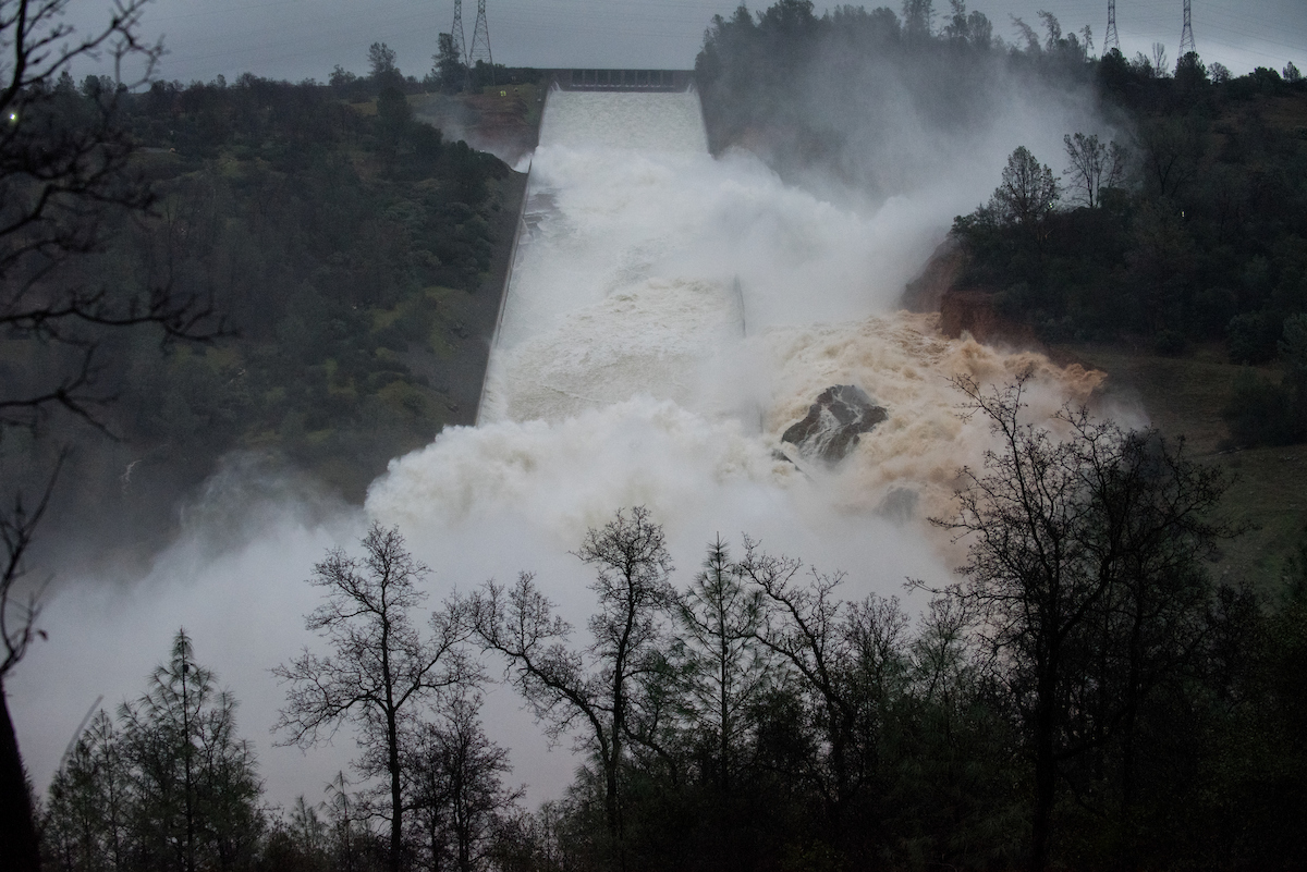

When operators at the nation’s tallest dam discovered a sizable section of missing concrete along its 178-foot-wide main spillway earlier this month, they did what most would assume they would do – slow the flow of water down the chute.
During this reduction, the water level of Northern California’s Lake Oroville peaked and an earthen emergency spillway was utilized for the first time. As water rushed down the spillway, the hillside below was significantly eroded.
The possibility of hillside collapse prompted the evacuation of more than 180,000 residents along the Feather River and raised questions as to the cause of both spillway failures.

Culprits
A process dubbed cavitation is to blame for the damage to the main spillway, according to dam experts cited in the media.
Cavitation is a process that occurs when large volumes of fast-flowing water rumble over small cracks and other imperfections in concrete dam spillways. When the water hits the surface of a chute, significant turbulence is created, which can form tiny water vapor bubbles that collapse with a force powerful enough to chisel away at concrete.
Spillways are often retrofitted with aerators, which reduces the risk of cavitation; however, Oroville’s chute had not been upgraded, with only crack-related repairs occurring in 2013. This fact, combined with a maximum concrete thickness of only 15 inches, made the spillway a prime candidate for the type of failure it experienced.

Another theory suggests that California’s recent, record-long drought caused the soil under the main spillway to dry and shrink, creating a void of several inches between concrete and dirt that was then exposed to large volumes of fast-moving water.
The erosion of the earthen emergency spillway’s hillside was not a huge surprise, as the area lacked a concrete lining – this being a long-time point of contention for environmental groups.
In 2005, organizations including the Sierra Club requested that the state line the emergency spillway with concrete, fearing catastrophic erosion could occur if it was ever utilized – the same reason for the recent evacuations. The request was rejected at the time and deemed unnecessary.

Spill the Details
- On February 7, dam operators observe turbulence in the water rushing down the main spillway’s chute. Upon reducing water flow, operators discover a large missing concrete section.
- Water releases remain slow for the next four days, wherein the lake rises by nearly 50 feet thanks to heavy storms.
- On February 11, the lake reaches its peak of more than 902 feet and overtops the emergency spillway.
- Rushing water coming down the earthen emergency spillway causes the hillside to erode badly, prompting state officials to order the evacuation of more than 180,000 residents along the Feather River. Observed erosion has raised concerns that the spillway could collapse, causing catastrophic flooding if further utilized.
- Erosion of the emergency spillway forces dam operators to increase water flows down the broken main spillway, which now features a rock-filled crevice – the result of helicopters dropping bags of boulders into the damaged section.
- Re-utilization of the main spillway and the filing of nine upstream reservoirs drops the lake’s level down roughly 50 feet in a week. The volume of water flowing down the spillway is reduced to around 55,000 to 60,000 cubic feet per second.
- Crews place rock, aggregate, and cement slurry into the emergency spillway’s eroded areas.

Currently, the damaged main spillway is still deteriorating, with state officials expecting further erosion as repairs are made. While the spillway’s left side now runs into earth, officials insist the chute is stable and that continual monitoring will occur as it is improved.
How a levee fails – California Department of Water Resources
What caused the Oroville Dam spillway failures, and were they preventable?
The Oroville Dam spillway failures were caused by cavitation, a process in which fast-flowing water creates turbulence, forming bubbles that collapse with force, damaging the concrete. The absence of retrofits and a maximum concrete thickness of 15 inches contributed to the failures.
What actions are being taken to repair the Oroville Dam spillway, and is there a threat to public safety?
Repair efforts include placing rock, aggregate, and cement slurry to address erosion, while ongoing monitoring ensures stability. Despite the damaged main spillway, officials assert stability, and with reduced water flows, there's no anticipated threat to public safety.

